

There are plenty of Hiking Trails in the Balkans. Short multi-day & day hikes in each country, depending on how much time you have.
Here are the ones I completed in 2018 in the months of August and September.
TABLE OF CONTENTS
ALBANIA
1 DAY HIKE FROM VALBONA VALLEY TO THETH
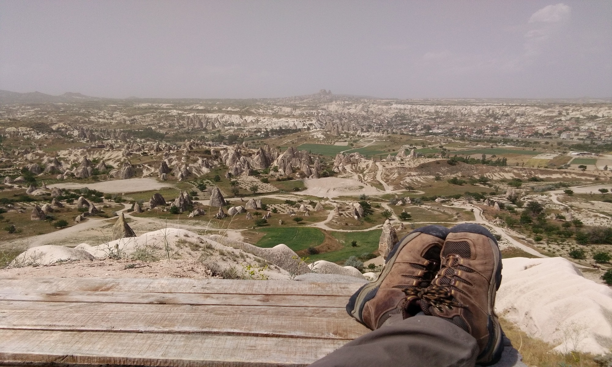
Hiking in the Accursed Mountains also known as the Prokletije in Northern Albania is a place I am definitely returning to. Stunning scenery, rivers and with short hiking trails in both Valbona and Theth valleys.

Valbona Valley.
GETTING THERE
You have a couple of ways to enter the area from Shkoder, the nearest major town in Northern Albania.
Note access to this area is only possible during summer. During winter the roads close due to snow and the inhabitants have returned to Shkoder or to other parts of Albania.
Option 1
Pay for a seat in a share 4×4 vehicle from Shkoder that will take you to Theth, taking between 2.5 – 4.5 hours
Option 2
Or do it the way I and many others did. Take a minibus to Lake Koman then a ferry to Fierze then another mini bus to the Valbona Valley. It is a beautiful journey along the lake to Fierze.

On one of the Lake Koman ferries.
Both options can be organized through the hostels in Shkoder (Approximately 1900 lek per person) covers all transport to the start of the hike if you choose not to stay in Valbona Valley. I organized transport through the Bulldog Guesthouse in Shkoder. Bulldog-hostel-club
There is plenty of available information on the web on Tripadvisor etc.
THE HIKE
This is an easy hike to follow and seems to be one of most popular hiking trails in the Balkans. There are plenty of trail markers on a well-worn trail and other hikers.
It is a more gradual climb to the ridge from the Valbona Valley side than the Theth side which is far steeper.

Looking back down the Valbona Valley.
Quite a few hikers were doing a round trip from Theth to the ridge and back which is a steep ascent. Well worth it for the fantastic views from the ridge once you get there.

The trail from Valbona to the ridge.
There are places to stay or camp along the way coming from either direction. If you choose to do so I would buy food supplies back in Shkoder as on the Valbona side of the trail there is very little in the way of shops and Theth’s main store is quite expensive and not much of a choice.

Theth Canyon.
From this area there is a major 10 day hike ‘The Peaks of the Balkans” Peaks-of-balkans-trek-beginners-guide that takes you through 3 countries Montenegro, Kosovo and Albania.
This is also the start of another major 1200 km hiking trail from Albania to Slovenia called the Via-Dinarica White Trail.

Grunasi Waterfall, Theth Valley.
Here is a site with a good Guide on Theth Hike-from-theth-to-valbona-peak also covers other attractions in the area.
SHORT HIKES ON THE VIA EGNATIA.

Via Egnatia, Quakes to Mirake, Albania
The Via Egnatia foundation is the go to source for the guide-book ‘Via Egnatia on Foot’ and GPX for hiking on this trail. The Via Egnatia is about 468 kilometers long, starting from Durres on the coast of Albania, crossing through Macedonia to Thessaloniki, Greece. I do recommend obtaining the GPX as without it you could spend most of your time on sealed roads as opposed to hiking the trails and dirt roads, which is far more interesting and enjoyable. The guide-book can be purchased online or brought in Durres, Albania.
Below I have included two short section hikes of the Via Egnatia that I have done. One of which I did twice. This was in addition to walking from Pella, Greece to Golem, Albania. The-Backpacking-Hiker-on-the-via-egnatia
3 DAY HIKE ON THE VIA EGNATIA FROM QUKES TO MIRAKE
This hike is easy to reach in Albania. A section that has great scenery and the best remains of the old Roman road on the Via_Egnatia plus of course some of the more than 173000+ bunkers built during the Communist Government of Enver Hoxha from the 1960s to the 1980s. Bunkers_in_Albania
GETTING THERE.
Starting from Elbasan I caught a minibus going east to Prrenjas (200 lek each). The driver dropped us off near Qukes, next to a bridge that spans the river which you will need to cross to join the trail.
Note: Make sure you have at least 3 liters of water at the start of the hike, as it will be a while before you can get access to village water sources.
THE HIKE
Day 1 Qukes to Dardhe
The hike follows mainly dirt roads between villages, steadily climbing up to a higher level on the mountains where you eventually have great views of the valley below as you continue along.
I camped between the villages of Dardhe and Spathar hoping I was far enough away to avoid the dogs. It did not work, they still found me.
Day 2 Dardhe to above Gostime

Part of the old Roman road.
This day I hiked past small and large bunkers and finally onto the old Roman road. I followed the road passing over sections that had fallen away into the valley leaving just enough room to inch my way along.

Bunkers.
Camped for the night high up on the ridge overlooking the village of Gostime. Fantastic views down into the valleys on either side. Great sunsets and sunrises. Unfortunately when night fell there were plenty of mosquitoes.
Day 3 Hiked from above Gostime to Mirake.

Old Roman road near Gostime
Continued along the old Roman road down into the valley past Gostime then onto a sealed road into Mirake. I caught one of the many mini buses back to Elbasan from the café on the main road.

View from the Via Egnatia, Albania.
MACEDONIA
2 DAY HIKE ON THE VIA EGNATIA FROM KAZHANI TO OHRID
GETTING THERE
This hike began outside the village of Kazhani. To get there you need to catch the Ohrid to Bitola bus, then asked to be dropped off on the main highway near the village. This hike is also part of my Via Egnatia hike from Pella Greece to Golem in Albania. The-Backpacking-Hiker-on-the-Via-Egnatia
NAVIGATION
I used the Via Egnatia App and way points for navigating long the route. This I brought through The Via Egnatia Foundation.https://www.viaegnatiafoundation.eu
THE HIKE
Day 1. Kazhani to Resen 16 kms.
This route took me along what appears to be parts of the old highway. It was a delight to walk along here as it was like being in your own fruit shop. There were black berry’s, plums, apples growing along the road and I gorged myself on them.
Hiking along the trail takes you past a church and down onto the edge of Pelister National Park then cross the new highway from there wound its way into the village of Sopotsko
I spent time exploring the village of Sopotsko, and had beers with the surprised locals and then on my way again to Resen, the next major town.
Accommodation for the night was in a hotel on the Resen to Bitola highway.
Day 2. Resen to Ohrid 25 kms.
This day started with hiking along the main highway into Resen then through to and up the other side up into the hills.

View of Lake Ohrid, Macedonia.
It was a long climb up through forest that takes you up onto the plateau above Lake Ohrid which finally gives you view of the lake as you descend towards the town of Ohrid.

ROMANIA
3 DAY FAGARAS MOUNTAINS HIKE
Romania has a number of hiking areas. I chose to do a short hike in August in the Fagaras Mountains which is a short bus drive from Brasov in Transylvania. The Fagaras really did surprise me in the variety of landscape. Climbing up the valley I decided to start the initial ascent, was a completely different natural environment than the valley I descended in, with the mountain range itself being bare but dotted with small lakes.
The weather was perfect. A little cool at night on top of the ridge but warm and humid down in the valleys.
There were a few day hikers among the overnight hikers scattered along the ridges. It is not a high mountain range (up to 2500m peaks) like the ones I hiked in Georgia but still impressive and in some areas quite tough assents if you are carrying a fully loaded pack.
GETTING THERE

Sambata Monastery
Caught the Brasov to Sibiu bus from Brasov Central Train Station. Got off in Sambata de Sus then hitch hiked to the Sambata Monastery.
NAVIGATION
Maps can be purchased at the Outdoor shops in Brasov. The woman there was very helpful providing plenty of advice as to which trail to hike in the time I had and how to get to the start.
THE HIKE
Day 1 Brasov to Cabana Valea Sambatei
Caught the Brasov to Sibiu bus to Sambata de Sus (18 Lei). No public transport so started hitch hiking. Finally made it to the Sambata Monastery where I started hiking up the valley following the jeep road up beside the river to the first camping area Cabana Valea Sambatei, 1401m.
The cabana was full as it was the weekend so I pitched my tent in one of the few level areas. In hindsight, another half and hours walk up the valley I would have found far nicer camping spots.
Day 2 Cabana Valea Sambatei

Climbing up to the ridge.
Started the nearly 800m climb up onto the ridge, Fereastra Mare a Sambetei 2188m. Passed through a large field of blueberries on the way up that became my breakfast supplement.

Once up onto the ridge there were awesome views down the valleys on either side. There is also a water source nearby. I continued hiking along the ridge, where I saw fantastic potential campsites along the way.

Up on the ridge.
The ridges and mountains are quite bare, no trees as such.
For my camp site for the night I descended down to a beautiful lake, in a bowl.

Camping in the Fagaras Mountains, Romania.
There were a few day hikers around but by nightfall only a few campers were left in the area.
Day 3 Victoria
Back up onto the ridge then a steep descent down into what turned out to be a beautiful walk down into the valley and through the forest and finally back onto a 4×4 road.

Fagaras Mountains.
Hitch hiked into Victoria, where I stayed at the Hotel Central.
The short hike was challenging especially along the ridge as parts of the trail became almost vertical. Definitely worth doing though.
The next day I caught the slow train to Sibiu further to the west.
travelguideromania.com/fagaras-mountains-the-highest-mountains-in-romania for more details on hiking in the Fagaras.
If you enjoyed reading this hiking blog, why not check out my other hiking blogs. The Backpacking-Hiker-on-the-Via-Egnatia Hiking-trails-in-the-Caucasus-mountains Lets-go-hiking-on-the-Bibbulmun-track-in-Western-Australia/
Inspiring!!
Thanks Graeme. Hope all is well at your end.